4D Air Traffic Coordination & Flight Path Simulator
Four-axis trajectories, with every reroute priced before it is offered.
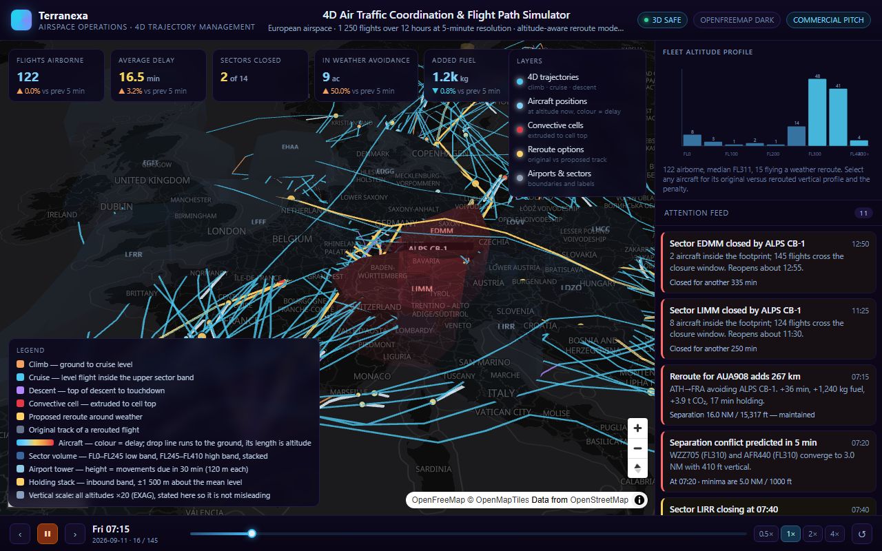
Captured from the running product. airtraffic4d.terranexamaps.com
Every trajectory is a four-axis object — latitude, longitude, altitude and time — so an operator sees the airspace volume a flight actually occupies, not just a line drawn on the ground.
Convective weather cells grow, drift across national boundaries and decay, closing the sectors they reach and forcing traffic out of them. Each proposed reroute carries its price in added track kilometres, flight minutes, fuel and CO2, and is checked against 5 NM / 1000 ft separation minima before it is offered as a plan.
What is actually running
- Four-axis trajectories — latitude, longitude, altitude and time — so the occupied airspace volume is visible.
- Convective cells grow, drift across borders and decay, closing sectors and displacing traffic.
- Every reroute priced in added kilometres, flight minutes, fuel and CO2.
- Proposals validated against 5 NM / 1000 ft separation minima before being offered.
Built with
Open the live product
This is the deployed application, not a recording. It opens in a new tab and runs in your browser.