Crop Health & Regional Stress Console
Four satellite and in-field signals fused into one regional stress view.
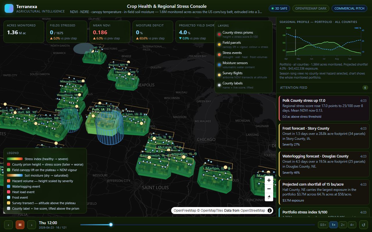
Captured from the running product. crophealth.terranexamaps.com
More than 1,600 farm parcels, 320+ in-field moisture sensors and four satellite vegetation indices — NDVI, NDRE, canopy temperature and soil moisture — are fused into a single live regional view across 1.6 million monitored acres.
County stress scores convert directly into projected yield shortfall and financial exposure in dollars per acre and in total, so the map ends in a budget number rather than a colour. The whole 180-day season is pre-computed deterministically, so every viewer sees exactly the same scene on every reload.
What is actually running
- Four independent signals fused: NDVI, NDRE, canopy temperature and in-field soil moisture.
- County stress scores convert straight into projected yield shortfall and dollars per acre.
- The whole 180-day season pre-computed deterministically, so the demo is reproducible on any machine.
- Built to be read by an executive, not only a GIS analyst: toggleable layers, a season scrubber and a per-county seasonal chart.
Built with
Open the live product
This is the deployed application, not a recording. It opens in a new tab and runs in your browser.